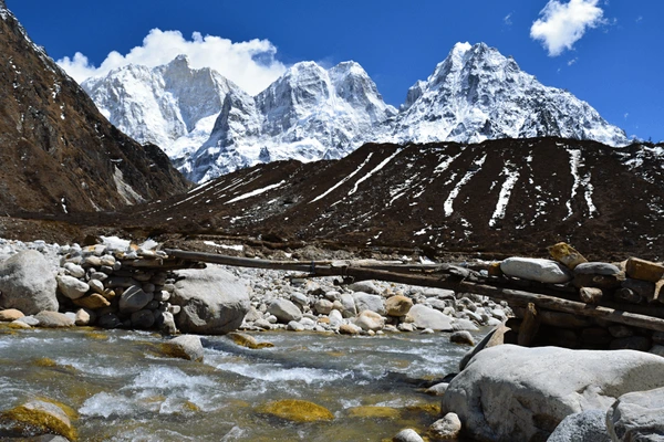
The journey begins at the sound of a river rushing beneath a swing bridge.
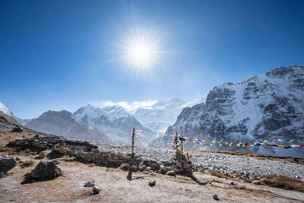
Prayer flags snap in the breeze, while the smell of woodsmoke drifts in from a tea house way off in the distance.
We are in Nepal’s far east, where Nepal, India and Tibet almost touch, on a trail that few people take, the Kanchenjunga North Base Camp Trek Route.
We know this route like our own backyard, at Bold Adventures Nepal.
It is wild. It is remote. It is authentic.
This is a place where mountains are not a view – they are a presence.
On every corner lies something new: red rhododendron forests, glacier rivers and even villages where life is barely changing.
The trek ends at Pangpema at 5,143 m – the Kanchenjunga North Base Camp.
Kanchenjunga, the third-highest mountain in the world, rises at this point, an immense wall of ice and rock.
But the magic is not only at the end;
It is in the journey itself, through valleys seldom seen by outsiders.
This blog is a detailed, step-by-step guide to the Kanchenjunga Trek route, where you will learn about distances, highlights, terrain, culture and trip preparation tips.
Introduction to the Kanchenjunga North Base Camp Trek Route

The Kanchenjunga North Base Camp trek area is one of the last truly wild adventures in Nepal.
This is NOT a trekking highway.
There are no large groups of trekkers, no long queues of trekkers in front of you and you will not hear the constant buzz of the tea houses throughout your trek.
You will spend your time walking through bamboo forests, clambering along rushing rivers and meeting locals who still live there.
You will start in the low hills of eastern Nepal and as you climb higher each day.
Every day will provide a new landscape and sensations of being deeper and deeper into the wilderness.
Kanchenjunga’s North Base Camp is at 5,143 meters.
Here in this remote and isolated location, Kanchenjunga Himal towers in the sky — a grand and massive wall of ice, snow and rock, with nearby giants like Jannu and Pyramid Peak.
The trek to reach this destination is exhausting, but absolutely worth the effort.
Where Does the North Base Camp Trek Begin and End?
The Kanchenjunga North Base Camp trek from Nepal begins with a scenic 45-minute flight to Bhadrapur airport from Kathmandu.
From Bhadrapur, it’s a long but scenic drive to Taplejung, with mountain views of tea gardens and hillside farms.
The Kanchenjunga North Base Camp trek route actually starts in Sekathum.
From there, you will hike along rivers and through forests to Pangpema – the Kanchenjunga North Base Camp, at 5,143 m.
Once at base camp, you will descend back to Sekathum, take a long drive back to Taplejung and then take the flight from Bhadrapur back to Kathmandu.
Pro Tip: If it’s a clear day, sit on the left side of the airplane for the best views of the Himalayas flying from Kathmandu to Bhadrapur.
What is special about the route?
Out of many trekking routes, this one is remote, quiet and culturally rich, which is located near the border of Nepal, India and China.
On the trek, you will travel through the Kanchenjunga Conservation area, experiencing a range of wildlife (rare animals) and visiting Tibetan-influenced villages like Ghunsa and Kambachen.
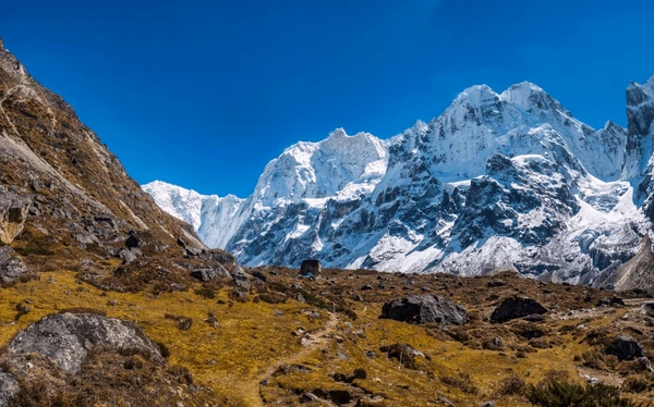
The scenery changes every step of the way, from lush green valleys to rocky moraines and a glacier-fringed base camp.
Pro tip: The one section of the trek from Kambachen to Lhonak has some of the absolute best views of Mount Jannu.
Accessing the Trail: Kathmandu to Bhadrapur to Taplejung
When you arrive at the Kanchenjunga North Base Camp trek route, it takes you away from city life into eastern Nepal with its slower pace.
The route begins with your flight away from Kathmandu and onward to tea-covered hills and serene market towns.
But to enter the trails, you must obtain the Kanchenjunga trek permits.
Flight and Road transfers explained
You’ll take an easy 45-minute flight from Kathmandu to Bhadrapur.
The Bhadrapur airport is small and efficient as you fly over Nepal’s flat, subtropical plains.
From Bhadrapur, the real overland travel begins.
There are three travel zones between Bhadrapur and Taplejung:
- The Terai Plains – You will leave the airport and head onto smooth and paved roads for easy driving.
- The Tea Hills of Ilam – The roads are paved highways but winding with lots of bends, usually with green terraces on both sides.
- Mountain roads to Taplejung – Roads become narrower and worse, with sections of rough gravel and landslides.
The ride is both scenic and slow, taking in total of 8-10 hours in a private jeep.
It should be understood that as you travel, the weather can change very quickly in Nepal; for example, if it’s warm and humid in the lowlands, you will feel cool and crisp when you finally arrive in Taplejung.
Pro Tip: Consider a 4WD vehicle. You will appreciate your comfort and safety. If you are prone to car sickness, then carry medication; the last 1.5 hours is a continuous series of hairpin turns.
Day-by-Day Breakdown of the Kanchenjunga North Base Camp Trek Route

Our Kanchenjunga Base Camp trek itinerary provides a complete 16-day trek in the Kanchenjunga region of eastern Nepal.
It allows gradual acclimatization, yet you will still spend time enjoying the incredible beauty and culture the region has to offer.
You will experience warm, lush valleys with tea-covered hills to icy glaciers and everything in between during the journey!
Our route includes lots of rest days scheduled in Ghunsa and Kambachen to allow for recovery days to help mitigate the chances of altitude sickness.
With the slow and more steady pace of the journey, you can really soak up and savour all of the incredible details along the way and enjoy every step!
| Day | Activity | Trek Distance in kilometers | Altitude in meters |
| 1 | Kathmandu to Bhadraur to Ilam | – | 1,670 m |
| 2 | Ilam to Taplejung | – | 1,820 m |
| 3 | Taplejung to Sekathum | – | 1,576 m |
| 4 | Sekathum to Amjilosa | 9 | 2,510 m |
| 5 | Amjilosa to Gyabla | 5 | 2,730 m |
| 6 | Gyabla to Ghusa | 6 | 3,595 m |
| 7 | Ghunsa (Rest Day) | – | 3,595 m |
| 8 | Ghunsa to Kamabachen | 7 | 4050 m |
| 9 | Kamabachen (Rest Day) | – | 4050 m |
| 10 | Kamabachen to Lhonak | 7 | 4785 m |
| 11 | Lhonak to Pangema to Lhonak | 18 | 5143 m |
| 12 | Lhonak to Ghunsa | 7 | 3595 m |
| 13 | Ghunsa to Amjilosa | 6 | 2510 m |
| 14 | Amjilosa to Sekathum | 9 | 1576 m |
| 15 | Sekathum to Talejung to Bhadrapur | – | 100 m |
| 16 | Bhadrapur to Kathmandu | – | 1300 m |
Did You Know? Pangpema sits higher than Everest Base Camp in Nepal, making it one of the highest trekking points in the country.
Day 1–5: Arrival and Forest Village Trek
It starts with a brief domestic flight from Kathmandu to Bhadrapur.
Then, you’ll be driven by jeep through the tea-covered hills of Ilam (1,627 m) to your overnight destination, where you can enjoy green terraces and mountain air.
On Day 2, you’ll continue driving to Taplejung (1,820 m), the main town in the area.
This is your first real glimpse of wilderness.
From trekking treats to yak wool blankets, everything is for sale.
Day 3: You’ll trek on by jeep to Sekathum (1,576 m).
By now, the road narrows and there are howling rivers below and the first of many suspension bridges – a taste of things to come on foot.
From Day 4 onwards, you’re walking.
The climb up to Amjilosa (2,510 m) is firm and steep in places, with bamboo forests, river trails and large wooden bridges creaking beneath your feet.
Day 5 continues on into more thicker forest: mossy rocks and small waterfalls.
Then you arrive at Gyabla (2,730 m), a Tibetan-dominated village with its houses made of stone and wood and the plume of smoke drifting from the chimneys.
Tip: While you are at Gyabla, do have a bowl of local butter tea – hot, salty and the perfect thing to sup on a cold evening.
Days 6–10: Ghunsa to Kambachen to Lhonak
Day 6 is a short day walk to Ghunsa (3,595 m), the largest village on the Kanchenjunga North Base Camp trek route.
The trek follows along the Ghunsa Khola river with rhododendrons blooming in the spring and golden birch foliage in autumn.
This is your initial good altitude jump and it is wise to go easy and hydrate!
Day 7 is a rest day at Ghunsa!
Many trekkers climb to Lhapka Peak Viewpoint (c. 4,100 m) for a stunning view of Jannu Himal and the glacier below.
This is the perfect chance to “warm up” for the high passes we are to face.
You depart on Day 8 for Kambachen (4,050 m).
The valley opens up considerably here, with rocky slopes and the river curving below.
You will begin to notice that the trees thin out and are spaced widely apart, a sure sign you’re entering alp country!
The summit of Mount Jannu juts out into the skyline with its extremely pointed peak.
The short Day 9 hike is this time to Lhonak (4,785 m) and you’ll have to navigate areas of erosional landslides and icy streams.
The route to Lhonak is actually open and you will feel thinner air.
You will find yourself surrounded by yak grazing lands in Lhonak, which is another point to mention in the guidebook, since the nights are always cold even in the autumn season.
Day 10 is the final slog to Pangpema / Kanchenjunga North Base Camp (5143m).
You will see here towering ice walls, hanging glaciers and the breathtaking north face of Mt Kanchenjunga.
It is the time that most hikers would ever dream of standing at the foot of the world’s third-highest mountain.
Pro-Tip: As you descend from Lhonak, consider sitting down and wrapping up, particularly if you find morning blasts in this area can still be spine-jolting despite sunshine.
Days 11–15: Final Journey to North Base Camp and Back
From Pangpema / Kanchenjunga North Base Camp (5,143 m) on Day 11, we start the epic descent back to Lhonak (4,785 m).
The high altitude trail is retraced, with views of hanging glaciers and the sheer, ice walls of Mt. Kanchenjunga.
Keep your camera close—the next few days provide ample photographic opportunities of the grandeur of the Himalayas.
On Day 12 of your Kanchenjunga North Base Camp trek route, we descend to Ghunsa (3,595 m) while walking along the Ghunsa Khola river, with immense views down the valley.
You begin to notice the return of oxygen in the air and the ease of walking (not too mention your body is rested from sitting in Base Camp).
On Day 13, we continue descending to Amjilosa (2,308 m), past hidden rhododendron forests, cascading waterfalls and Sherpa villages.
Day 14 takes you to the small village of Chirwa (1,270 m), a warm air, lush green returning to the hills of Taplejung.
Day 15, the last legs of the trek on lower trails, bring you back full circle on one of the most satisfying yet challenging treks in Nepal.
If you are keeping tabs on the Kanchenjunga base camp trek distance, these last days cover a lot of ground but will be at a pace that respects your waning stamina and also respects your enjoyment.
Pro Tip: This return route is also a wonderful opportunity to discover Himalayan species biodiversity and document traditional village life, adding richness to your trekking story.
Overview of Total Route Distance and Elevation Gain
With the facts about the total distance and the altitude profile of the trek laid out before, it is easier for you to do the planning for the Kanchenjunga Base Camp trek.
This remote Himalayan trek is characterized by steep ascents, slow gains and incredible views.
This trek is always going to be a test of endurance and acclimatization!
Total Trekking Distance and Highest Elevation
The total distance for the Kanchenjunga North Base Camp trek is roughly 90–95 km in one way, depending on how exactly you go and whatever you may add in terms of side hikes.
The highest point of trekking is the base camp located on Pangpema, at approximately 5,143 meters.
Trekkers are at the most risk for altitude sickness at this location, which is why we include acclimatization days in places such as Ghunsa and Lhonak.
Daily Elevation Gain with changes in terrain
The daily hiking varies from easy gradual gain through the forests to very steep up-climbs along the Kanchenjunga Glacier and it will always be challenging.
For example, the trek from Kambachen to Lhonak features a substantial altitude gain (700 m), as well as varying terrains such as rocky moraines and high alpine meadows.
On average, we will usually include a daily elevation gain of between 400–800 meters, with leisurely acclimatization rest days, before the severe uphill pushes to the higher camps.
Types of Terrain & Trail Conditions along the Trail
From easy trails through village paths to inclines that are steep and glacial approaches, the Kanchenjunga trek route is a journey through Nepal’s most diverse terrain.
Along the way, you will find terrain changes more drastically, from soft ground of the forest to rocky moraines to icy edges of glaciers.
This means you will have to be both physically prepared and mentally flexible.
Forests, Moraines & High-Alpine Zone
The Kanchenjunga North Base Camp trek route officially begins with walking on trails through dense forests of rhododendron, oaks and pines.
As you gain altitude, the dense green corridors yield to heavy rock moraine fields born of ancient glaciers.
The Kanchenjunga Glacier, near Pangpema, offers an amazing sight for trekkers.
It is surrounded by a rough, high-alpine zone, where air is thin, the sky is blue and craggy peaks stretch across every horizon.
Varying terrain types and variations give the trek visual splendor and physical challenge to make it probably the most dramatic trek in Nepal.
Teahouse Options and Camping Alternatives
There is a variety of accommodation available on the route, offering a mix of rustic tea houses and camp trek experiences in remote sections.
While lower villages provide you a warm bed, a home-cooked meal, and an authentic opportunity to experience the local culture, higher altitude sections may necessitate camping under the stars.
Many trekkers will combine both styles of accommodation to appreciate the sociability of tea houses as well as the more raw adventure of camping closer to the mountains.
Having both options provides peace of mind knowing you will always be prepared for what the trail and changing conditions provide along the way, as well as the local Himalayan hospitality
Top Highlights Along the Kanchenjunga North Route

Ghunsa Village & Sherpa Culture
Ghunsa is the center of the Kanchenjunga Conservation Area, and an ideal place to spend acclimatization days.
This idyllic traditional village is characterized by Sherpa welcoming hospitality, decades of monasteries, and multicolored prayer flags blowing in the wind.
You can meander through narrow stone paths, drink butter tea with locals, and listen to stories from locals reminiscing on days past.
More than a stop, Ghunsa is a full cultural experience that will undoubtedly give you a deeper connection to the mountains you are soon to trek.
Lhonak and Kanchenjunga Glacier Point
As you trek from Lhonak to Ghunsa and further afield, you’ll have a close-up to the raw power of the Himalayas.
Lhonak sits in a wide-open valley with dramatic views of the snow-covered ridges.
However, the true magic happens beyond that — the Kanchenjunga Glacier viewpoint.
On Day 14, you will stand in front of a massive ice wall while watching the glacier carve its path through the mountains.
Trekking highlights don’t get much better than this! It truly feels like you are standing on the edge of the world.
Is the North Base Camp Route the Right Choice for You?
Before deciding to take the Kanchenjunga North Base Camp trek route, consider how experienced you are as a trekker, your level of fitness and if you’re ready to do a high-altitude trek.
This trek route is remote, has a steep ascent and a few high passes, making it the most challenging trek that you will face on a properly planned trek.
Trek Difficulty: If you are wondering, “How Difficult is the Kanchenjunga North Base Camp Trek?” then know that this trek has a moderate to strenuous difficulty with long walking days and undulating terrain.
Altitude Sickness Risks: There is a considerable risk of altitude sickness as the trek goes over 5,000m, and in this case, acclimatization is very important in order to avoid symptoms of altitude sickness.
Guided Groups: You can do solo trekking on this route, but this is not recommended for novices. Going with a guided group is safer, takes the stress away from navigation and provides a cultural aspect to the trek.
If you are an experienced trekker looking for a challenging Himalayan trek, the North Base Camp route will not disappoint, offering you stunning views, jaw-dropping landscapes and an interesting cultural experience.
Final Thoughts – Planning Your Itinerary with Bold Adventure Nepal
The Kanchenjunga North Base Camp trek is more than a lengthy hike in Nepal; it is a journey into one of the most pristine and remote areas of the Himalayas.
The trek encompasses dense forests to glacier traversing, Sherpa culture to panoramic views of the Himalayas and every step of your journey is part of an extraordinary adventure!
When you book with Bold Adventures Nepal, you are not only booking a trek, but you are also booking a trustworthy partner who will help you travel safely and feel welcome and make your experience as practical as possible through sharing their insights with you.
Our team can assist you with a fully guided trek, a customized itinerary or some other variant you might want.
Contact us and let us help you plan your route!
FAQs About the Kanchenjunga North Base Camp Trek Route
How far is the Kanchenjunga North Base Camp trek?
The trek is approximately 90–100 km from start to finish, depending on your route and side trips.
How long does it take to get to North Base Camp?
Most itineraries will have you at the North Base Camp in 10–12 days. This is in addition to the days required to acclimatize.
Is the trail marked and can you do it as a solo hiker?
Some parts of the trail are marked, but you can not trek as a solo hiker anymore, according to new trekking regulations.
Trekking with a guide is mandatory for safety and understanding of the culture and terrain you’re trekking through.
Can beginners do the Kanchenjunga trek if they have a guide?
Yes. Beginners should train in advance to prepare themselves for a high-altitude trek.
A guided trek will significantly improve your chances of success.


Recent Comments